STC Spatial Insights
Bridging Reality and Digital Innovation
3D Laser Scanning, Metrology, and Data Processing for the AEC & CRE industries
Get ahead with our 3D Laser Scanning, Metrology, and Reality Capture solutions.
We quickly gather accurate as-built conditions, dimensions, and plans of any building or site using advanced Survey Techniques.
Precision 3D Data: Your Foundation for Smarter Projects
Our Data Processing expertise delivers immediate value with Point Clouds, 2D CAD drawings, and 3D BIM models – all designed to expedite your planning and drastically cut down on risks, change orders, delays, and costs.
Specializing in As-Built Documentation, Reverse Engineering, and Digital Heritage.
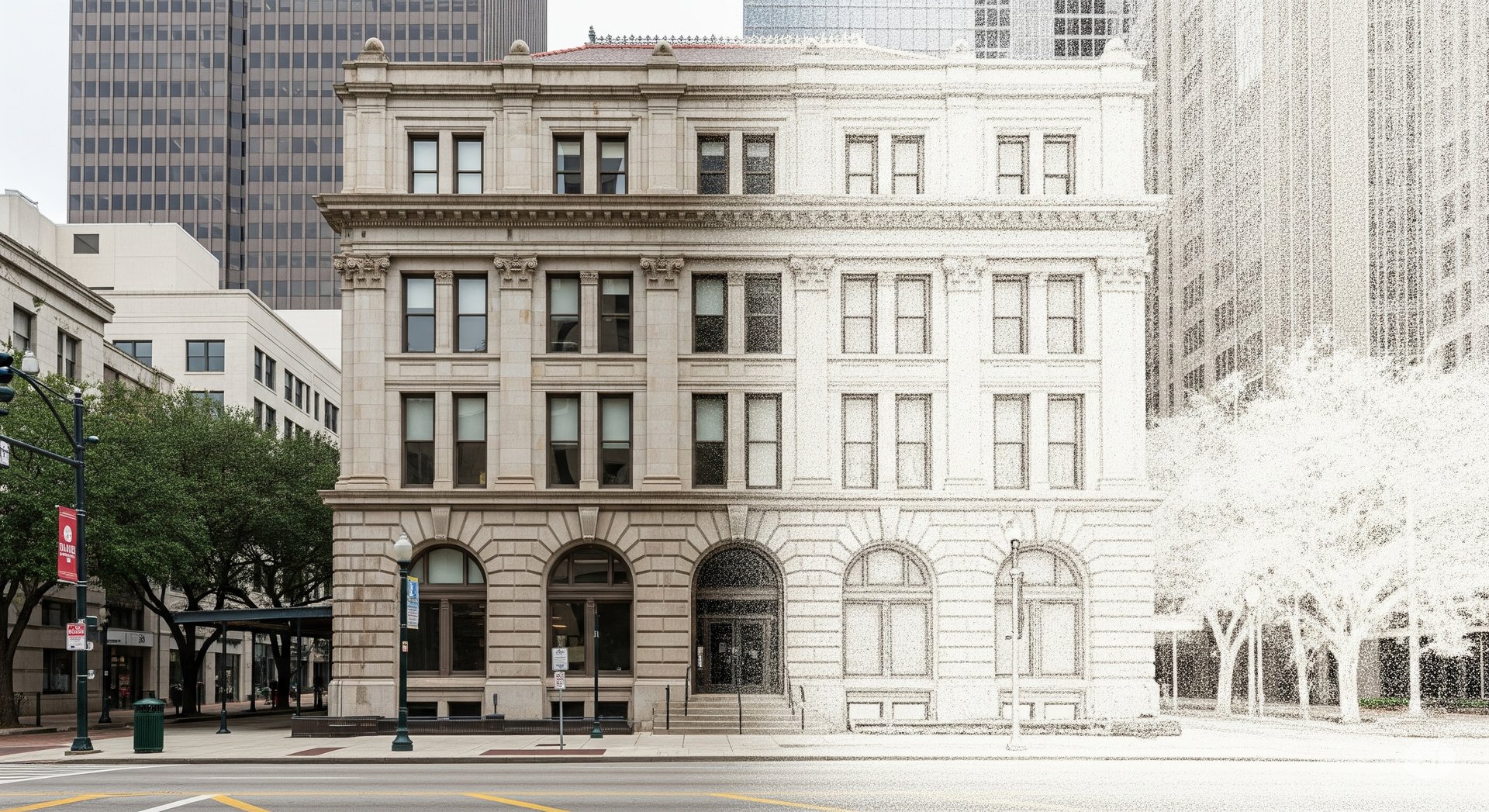
Capture exact architectural, structural, and MEP dimensions and layouts of existing buildings, facilities, and sites in a points cloud, for EAC and CRE Industries.
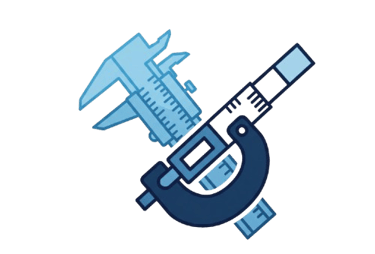
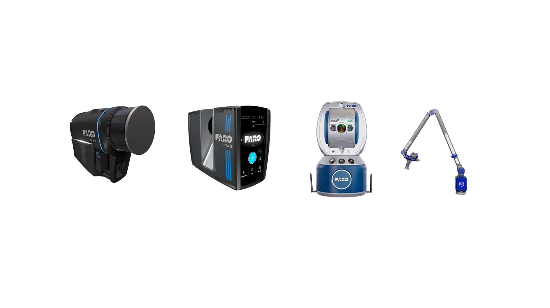
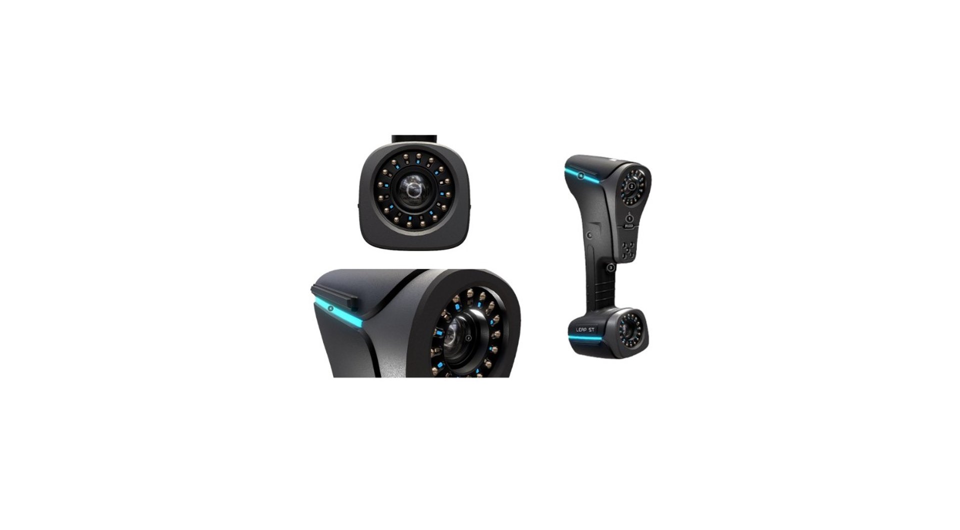
At STC Spatial Insights, we specialize in advanced 3D metrology services, offering precise measurement and in-depth analysis of your three-dimensional objects.
3D data capture revolutionizes the reverse-engineering process, allowing operators to digitize complex geometries in minutes and create digital models as future design files.
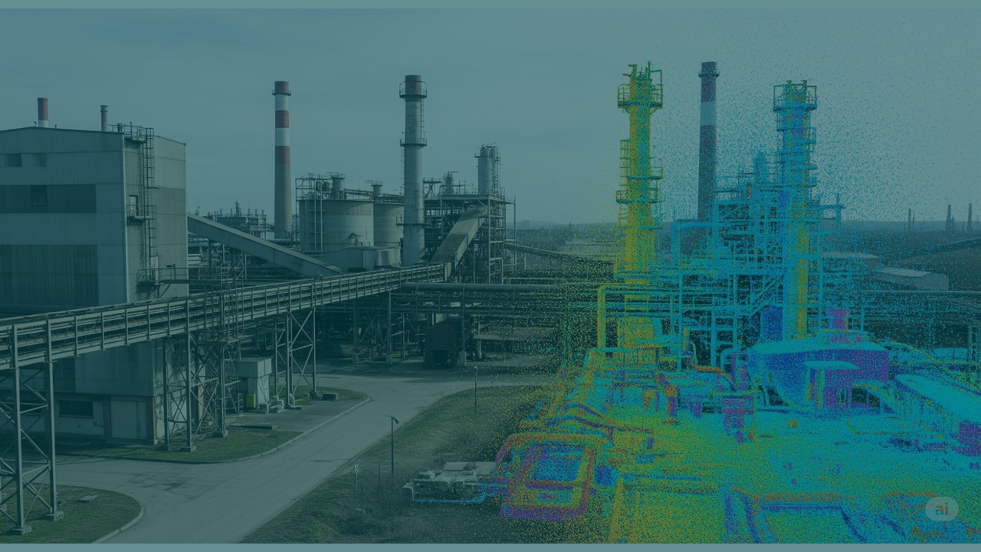
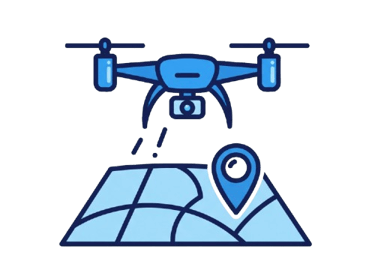
Transforming real-world environments into precise, actionable digital assets. Using advanced Lidar and photogrammetry, we create detailed digital outputs for your projects.
Preserve history with precision. Our 3D laser scanning creates accurate Digital Heritage solutions, offering detailed digital replicas for documentation and future generations.
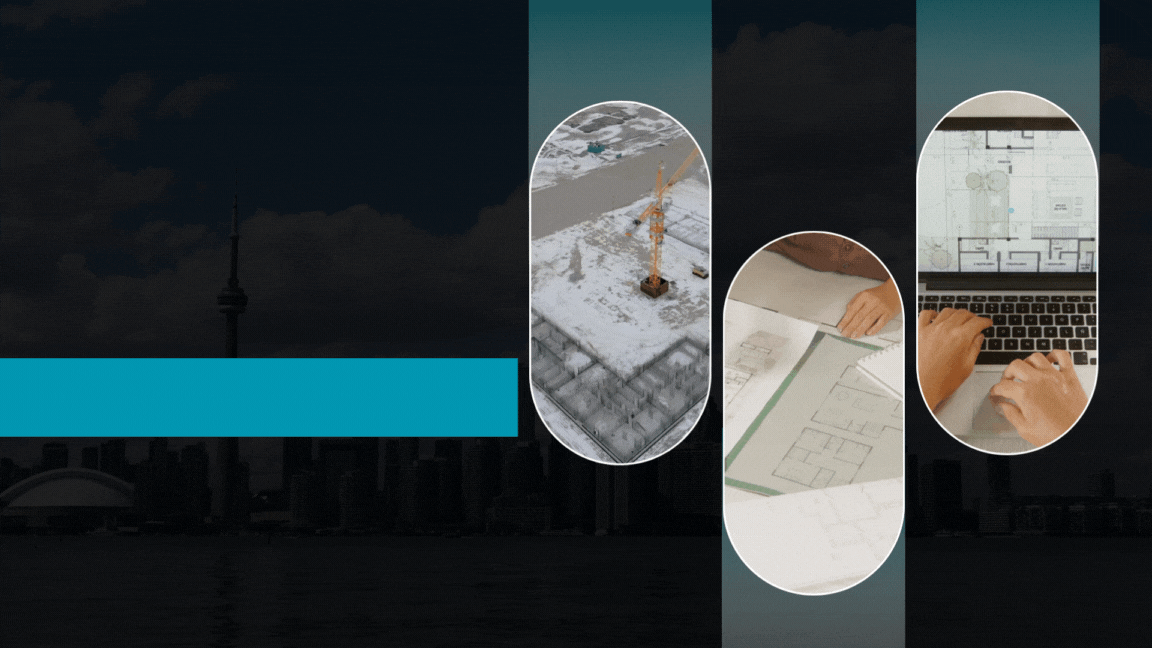
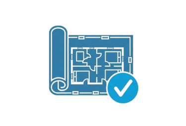
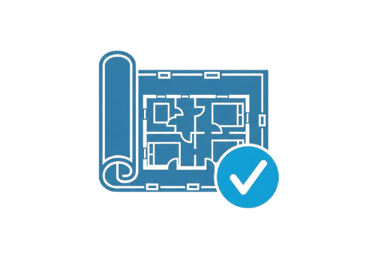
Get precise, up-to-date architectural documentation: floor plans, elevations, sections, isometric drawings, and essential deliverables.
Our Services
Capture exact architectural, structural, and MEP dimensions and layouts of existing buildings, facilities, and sites in a points cloud, for EAC and CRE Industries.
At STC Spatial Insights, we specialize in advanced 3D metrology services, offering precise measurement and in-depth analysis of your three-dimensional objects.
3D data capture revolutionizes the reverse-engineering process, allowing operators to digitize complex geometries in minutes and create digital models as future design files.
Transforming real-world environments into precise, actionable digital assets. Using advanced Lidar and photogrammetry, we create detailed digital outputs for your projects.
Preserve history with precision. Our 3D laser scanning creates accurate Digital Heritage solutions, offering detailed digital replicas for documentation and future generations.
Get precise, up-to-date architectural documentation: floor plans, elevations, sections, isometric drawings, and essential deliverables.
Our Services


STC Spatial Insights
Bridging Reality and Digital Innovation
3D Laser Scanning, Metrology, and Data Processing for the AEC & CRE industries

Get ahead with our 3D Laser Scanning, Metrology, and Reality Capture solutions.
We quickly gather accurate as-built conditions, dimensions, and plans of any building or site using advanced Survey Techniques.
Precision 3D Data: Your Foundation for Smarter Projects
Our Data Processing expertise delivers immediate value with Point Clouds, 2D CAD drawings, and 3D BIM models – all designed to expedite your planning and drastically cut down on risks, change orders, delays, and costs.
Specializing in As-Built Documentation, Reverse Engineering, and Digital Heritage.
STC Spatial Insights
Bridging Reality and Digital Innovation
3D Laser Scanning, Metrology, and Data Processing for the AEC & CRE industries

STC Spatial Insights
Bridging Reality and Digital Innovation
3D Laser Scanning, Metrology, and Data Processing for the AEC & CRE industries
STC Spatial Insights
Bridging Reality and Digital Innovation
3D Laser Scanning, Metrology, and Data Processing for the AEC & CRE industries
STC Spatial Insights
Bridging Reality and Digital Innovation
3D Laser Scanning, Metrology, and Data Processing for the AEC & CRE industries
STC Spatial Insights
Bridging Reality and Digital Innovation
3D Laser Scanning, Metrology, and Data Processing for the AEC & CRE industries
STC Spatial Insights
Bridging Reality and Digital Innovation
3D Laser Scanning, Metrology, and Data Processing for the AEC & CRE industries
Capture exact architectural, structural, and MEP dimensions and layouts of existing buildings, facilities, and sites in a points cloud, for EAC and CRE Industries.
At STC Spatial Insights, we specialize in advanced 3D metrology services, offering precise measurement and in-depth analysis of your three-dimensional objects.
3D data capture revolutionizes the reverse-engineering process, allowing operators to digitize complex geometries in minutes and create digital models as future design files.
Transforming real-world environments into precise, actionable digital assets. Using advanced Lidar and photogrammetry, we create detailed digital outputs for your projects.
Preserve history with precision. Our 3D laser scanning creates accurate Digital Heritage solutions, offering detailed digital replicas for documentation and future generations.
Get precise, up-to-date architectural documentation: floor plans, elevations, sections, isometric drawings, and essential deliverables.
Our Services
Contact us today! You can call us directly at +1 (281) 207-1338
or send an email to info@stcspatialinsights.com.
Capture exact architectural, structural, and MEP dimensions and layouts of existing buildings, facilities, and sites in a points cloud.
At STC Spatial Insights, we specialize in advanced 3D metrology services, offering precise measurement and in-depth analysis of your three-dimensional objects.
3D data capture revolutionizes the reverse-engineering process, allowing operators to digitize complex geometries in minutes and create digital models as future design files.
Reality capture with Lidar or phorogrammetry creates accurate 3D models and digital twins for streamlined planning, construction, and asset management.
Preserve history with precision. Our 3D laser scanning creates accurate Digital Heritage solutions, offering detailed digital replicas for documentation and future generations.
Get precise, up-to-date architectural documentation: floor plans, elevations, sections, isometric drawings, and essential deliverables.
Our Services
Contact us today! You can call us directly at +1 (281) 207-1338
or send an email to info@stcspatialinsights.com.

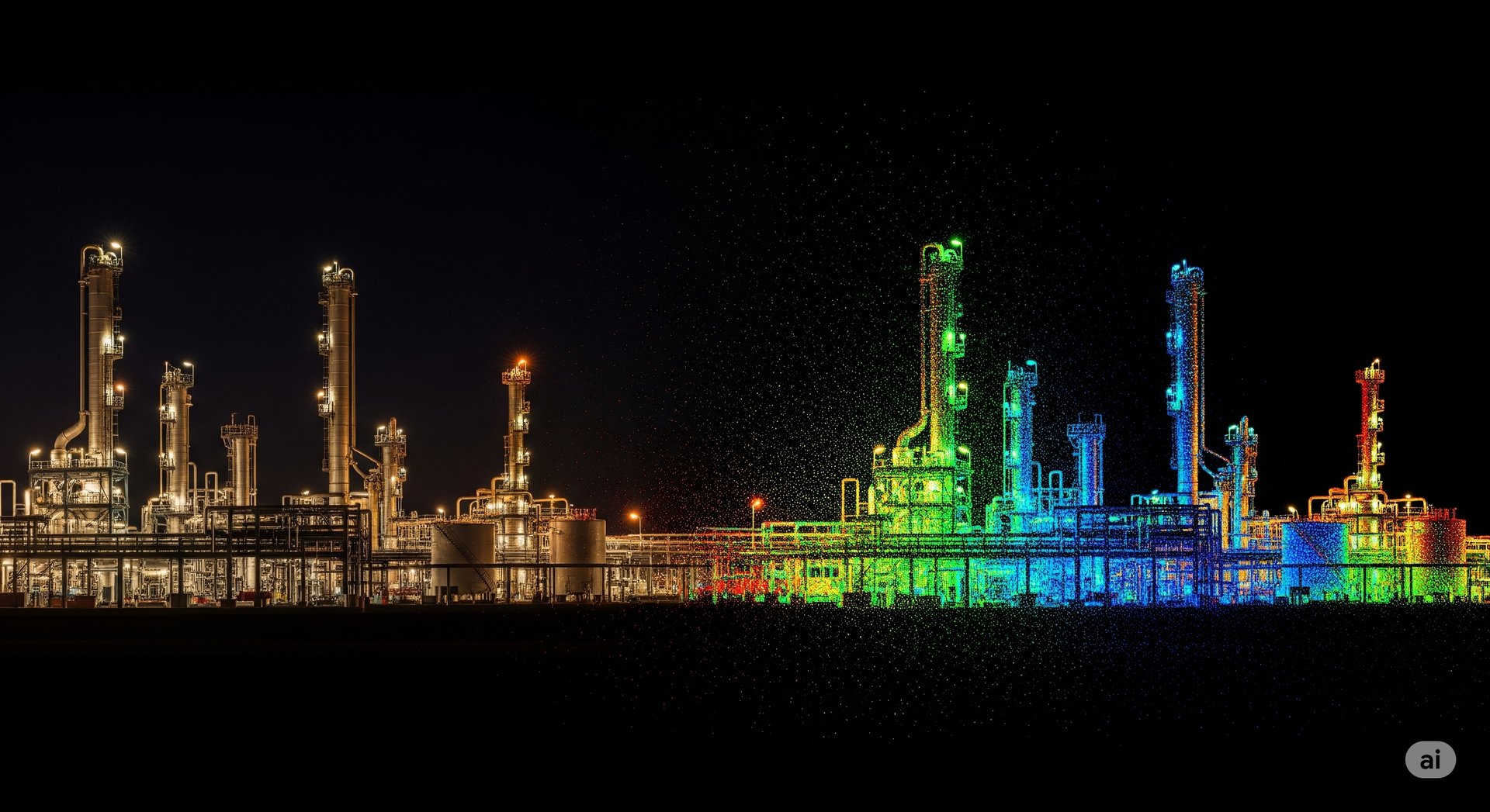
Industrial Plants and Power
Before a switch is flipped, a power plant's working components must be checked for precision, repeatability of performance and accuracy. We are here to support you
In the architecture, engineering and construction (AEC) industry, the 3D capture and layout tools are the way to world gets built today
Our precision measurement technologies lead the way in automotive engineering, manufacturing and inspection operations
AEC Industry
Automotive Manufacturing
Metalworking and Machining
Accuracy is key for forming, joining and cutting metals. With a wide range of portable solutions, you can measure parts with great accuracy, right on the shop floor
Heavy Equipment
The heavy construction equipment industry requires a focus on details. Precision and accuracy make the difference
Aerospace Industry
Capture exact architectural, structural, and MEP dimensions and layouts of existing buildings, facilities, and sites in a points cloud
Applications
From innovative startups to global leaders, companies across manufacturing, energy, oil and gas, packaging, chemical, and wood processing industries trust us for precise, forward-thinking 3D scanning, metrology, and data processing solutions.
Proudly Serving
We believe in the power of collaboration to deliver exceptional value and comprehensive solutions. Our partners strengthen our ability to offer a wider range of integrated solutions and leverage specialized expertise and cutting-edge technologies.
Our Partners

Industrial Plants and Power
Before a switch is flipped, a power plant's working components must be checked for precision, repeatability of performance and accuracy. We are here to support you
In the architecture, engineering and construction (AEC) industry, the 3D capture and layout tools are the way to world gets built today
Our precision measurement technologies lead the way in automotive engineering, manufacturing and inspection operations
AEC Industry
Automotive Manufacturing
Metalworking and Machining
Accuracy is key for forming, joining and cutting metals. With a wide range of portable solutions, you can measure parts with great accuracy, right on the shop floor
Heavy Equipment
The heavy construction equipment industry requires a focus on details. Precision and accuracy make the difference
Aerospace Industry
Capture exact architectural, structural, and MEP dimensions and layouts of existing buildings, facilities, and sites in a points cloud
Applications

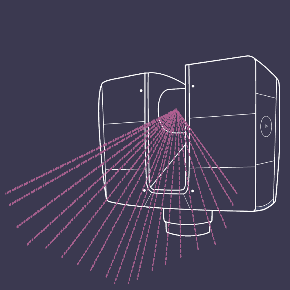
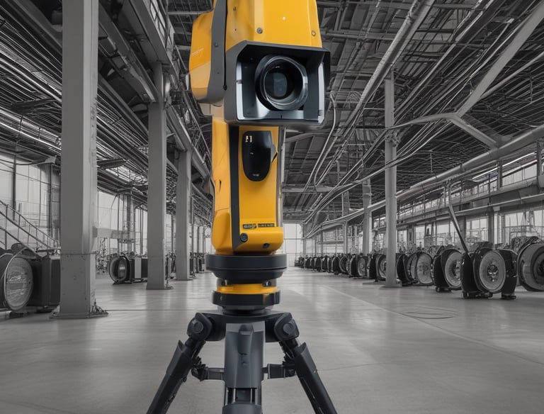
3D Laser Scanning
Capture exact architectural, structural, and MEP dimensions and layouts of existing buildings, facilities, and sites in a points cloud
Reality capture with Lidar or phorogrammetry creates accurate 3D models and digital twins for streamlined planning, construction, and asset management
Digitally capture MEP/FP system elements to improve design, engineering, prefabrication, coordination, and fit-out.
Reality Capture
MEP Documentation
3D BIM Modeling
A digital twin of buildings and infrastructure advances collaboration on design, construction, and operations
Expert Support & Consultation
Get direct access to our most knowledgeable staff and priority assistance for your project.
As-Built Documentation
Receive up-to-date floor plans, elevations, sections, details, isometric drawinfs, reflected ceiling plans, and more.
STC Spatial Insights
Bridging Reality and Digital Innovation
3D Laser Scanning
Capture exact architectural, structural, and MEP dimensions and layouts of existing buildings, facilities, and sites in a points cloud
Reality capture with Lidar or phorogrammetry creates accurate 3D models and digital twins for streamlined planning, construction, and asset management
Digitally capture MEP/FP system elements to improve design, engineering, prefabrication, coordination, and fit-out.
Reality Capture
MEP Documentation
3D BIM Modeling
A digital twin of buildings and infrastructure advances collaboration on design, construction, and operations
Expert Support & Consultation
Get direct access to our most knowledgeable staff and priority assistance for your project.
As-Built Documentation
Receive up-to-date floor plans, elevations, sections, details, isometric drawinfs, reflected ceiling plans, and more.
Innovation in
3D Laser Scanning
At STC Spatial Insights, we offer advanced 3D laser scanning services and digital modeling solutions for various industries, ensuring precision and quality in every project
150+
50+
Satisfied Customers
Solutions Delivered
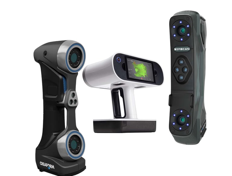
Scanning Services
We offer innovative 3D laser scanning and advanced modeling solutions for diverse needs.
Onsite Services
3D Laser Scannning | Metrology Services Drone Survey | Photogrammetry Topography | Training


Data Processing
Reverse Engineering | As-Built Documentation 3D Modeling | Digital Twins | 3D Mapping Digital Heritage Solutions | Ultra-realistic 3D Models | 3D BIM Modeling
3D Laser Scanning (Terrestrial / Handheld) Metrology Equipment | Drones (Lidar & Aero-Camaras / RTK GNNS) | Total Stations | Accesories | Specific Software
Rentals
Reach Us
Available 24/7 every day
Assistance
+1 281 207 1338
Email Us
info@stcspatialinsights.com