Capturing Environments with Precision
3D Mapping
Transforming real-world environments into precise, actionable digital assets. Using advanced Lidar and photogrammetry, we create detailed digital outputs.
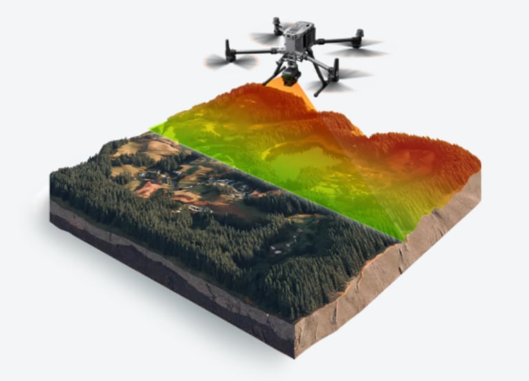
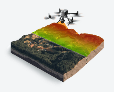
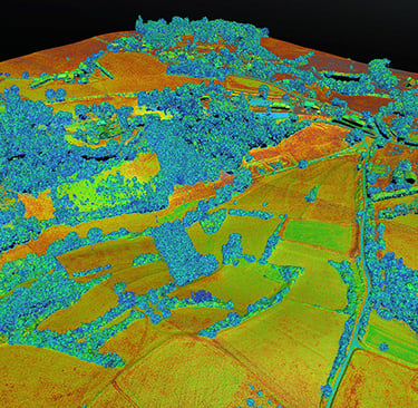
3D mapping converts the physical world into highly accurate, actionable digital representations.
Using advanced Lidar and photogrammetry, we capture vast data to generate precise 3D Point Clouds.
From these, we create detailed Orthomosaic Maps (seamless, true-to-scale aerial images), Digital Surface Models (DSMs) (capturing all terrain features), Digital Elevation Models (DEMs) (bare ground topography), and Digital Terrain Models (DTMs) (highlighting specific terrain features).
The result is a suite of highly accurate 3D models that empower streamlined planning, efficient construction, and smarter asset management across various industries
Orthomosaic Maps: We combine numerous aerial photos to create highly accurate, true-to-scale, distortion-free maps – a perfect, detailed top-down view of your area.
Digital Surface Models (DSMs): Get a complete picture of the terrain, including all natural and man-made features like buildings, trees, and other structures.
Digital Elevation Models (DEMs): We precisely represent the bare ground surface, filtering out objects to show the true topography and elevation.
Digital Terrain Models (DTMs): Specifically designed to highlight natural terrain features, ensuring clear visualization of landscapes.
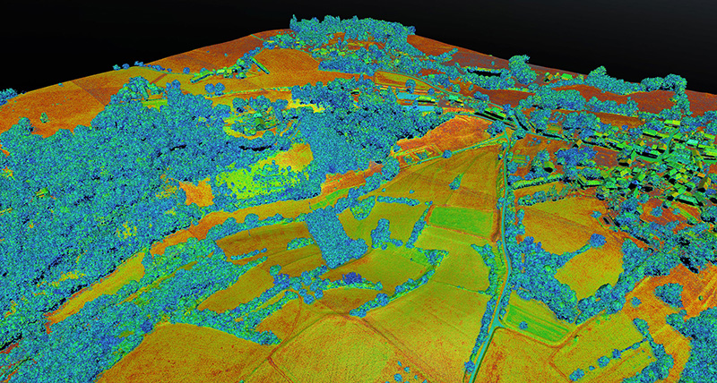
3D Point Clouds: Our scanners produce high-resolution data, capturing millions of individual data points in a given space to form the foundation of all our 3D models.
3D Mapping: The Digital Landscape
Ready to transform your project?
Contact us today! You can call us directly at +1 (281) 207-1338
or send an email to info@stcspatialinsights.com.
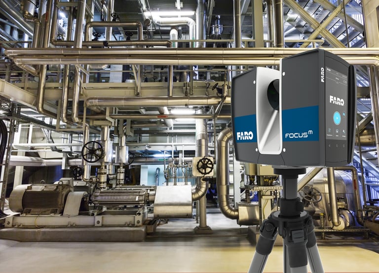
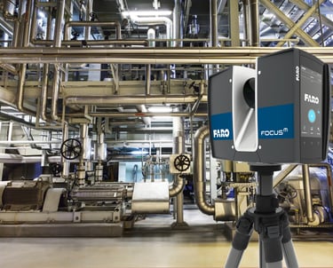
3D Laser Scanning
Capture exact architectural, structural, and MEP dimensions and layouts of existing buildings, facilities, and sites in a points cloud, for EAC and CRE Industries.
Put the power of 3D laser scanning in the hands of our experts.
We capture your site with extreme detail, providing highly accurate and efficient 3D visualization solutions to support your planning, design, and construction.
Our comprehensive scanning service converts physical reality into immersive data, replacing uncertainty with confident decision-making.
We're not just scanning specialists; we're your partners in delivering the precise outcomes you need.
Unmatched Accuracy and Detail: Captures millions of data points with millimeter or even sub-millimeter precision, providing an incredibly accurate and comprehensive digital representation of the existing conditions. This virtually eliminates human error in measurements.
Rapid Data Capture: Collects vast amounts of data much faster than traditional manual methods, significantly reducing on-site time and expediting project timelines.
Cost Savings:
Reduced Rework: High accuracy and early clash detection minimize costly errors, delays, and rework during construction.
Fewer Site Visits: Comprehensive data capture often reduces the need for multiple revisits to the site for additional measurements.
Optimized Material Use: Precise measurements lead to more accurate material orders, reducing waste.
Enhanced Planning and Design: Provides architects, engineers, and designers with a complete and accurate "as-built" model to work from, allowing for:
Better Clash Detection: Identifies potential conflicts between design elements (e.g., HVAC, plumbing, structural) before construction begins.
Improved Design Confidence: Ensures designs align perfectly with existing conditions.
Streamlined Prefabrication: Enables precise off-site fabrication of components.
Improved Safety: Allows for remote data collection in hazardous, hard-to-reach, or unstable environments, minimizing the need for personnel to be in dangerous situations.
Comprehensive Documentation: Creates a detailed and permanent digital record of the site at a specific point in time, invaluable for:
As-Built Verification: Compares constructed elements against design plans.
Facility Management: Provides accurate data for ongoing maintenance, modifications, and expansions.
Historical Preservation: Captures intricate details of heritage sites for documentation and restoration.
Enhanced Collaboration and Communication: Provides a shared, precise 3D model that all project stakeholders (architects, engineers, contractors, clients) can access and understand, fostering better communication and decision-making, even for remote teams.
Reduced Risk: By providing highly accurate data and enabling early problem identification, 3D laser scanning significantly mitigates project risks, including cost overruns and delays.
Digital Twin Creation: The captured data forms the foundation for creating a "digital twin" of a facility, allowing for real-time monitoring, analysis, and simulation throughout its lifecycle
Capturing Certainty: The Power of 3D Laser Scanning
Ready to transform your project?
Contact us today! You can call us directly at +1 (281) 207-1338
or send an email to info@stcspatialinsights.com.
STC Spatial Insights
Bridging Reality and Digital Innovation
3D Laser Scanning, Metrology, and Data Processing for the AEC & CRE industries